|
White Rock Gap - Torry Ridge Loop |
|
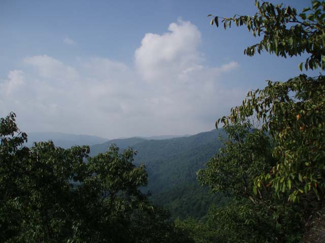
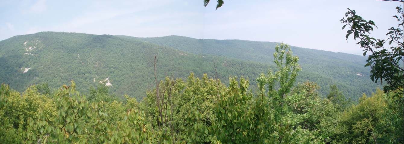
Description: This is a moderate 9.7 mile loop that includes a ridge walk, 2 scenic lakes, 4 vistas, a stroll high above a creek and a visit to a 30 foot waterfall (if the creek is running well). Although this hike is rated moderate most of the hard work is finished by the end of the second mile. If you want to see White Rock Falls at its best consider doing this one in the spring. South of Mile Marker 18 turn into an unsigned clay and gravel parking area on the west side of the parkway. This is the beginning and end of the hike. |
|
________________________________________ |
|
Zipped National Geographic. TOPO! GPS and Universal GPX Files |
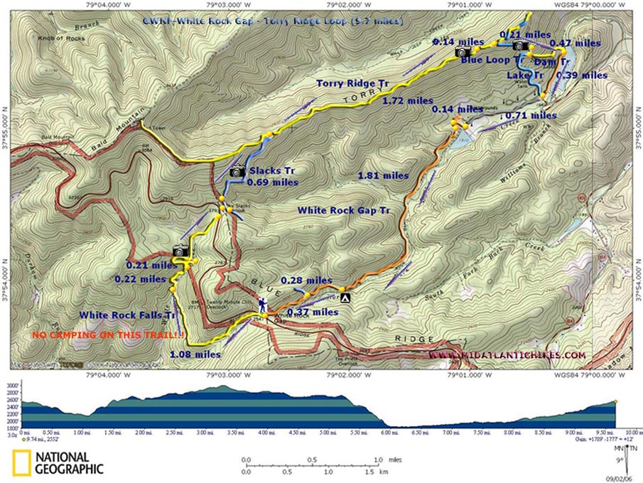
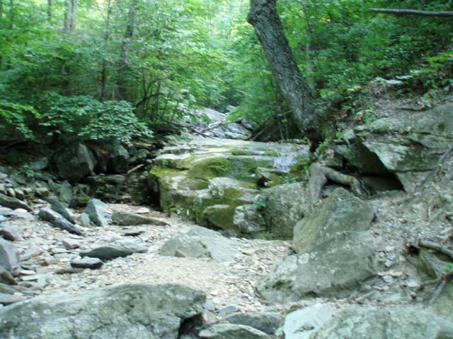
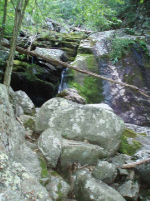
Trail Notes: All trails are signed (except the Lakeside Tr) and blazed. Blazes are far apart. From the parking area cross the Blue Ridge Parkway and pickup the yellow blazed White Rock Falls Tr. NOTE: NO CAMPING IS ALLOWED ON THIS TRAIL!!! Pass the trailhead sign noting that the falls are at 1.4 miles. Gradually descend White Rocks Tr. At 1.08 miles cross White Rock Creek and begin climbing out of the gorge. At 0.22 miles after the crossing look for a sketchy, unmarked spur trail that leads to a set of small falls below the main one. After visiting these continue climbing via switchbacks. At the top of one switchback you will be in front of a huge rock face which runs off to the right. The main trail goes to the left. Turn right and follow the rock outcrops to the base of the 30 foot White Rocks Falls. After visiting the falls retrace your steps back to the main trail and continue climbing. After the next set of switchbacks arrive at the top of the white rocks and a view over the creek valley. In about 0.5 miles arrive at the Blue Ridge Parkway. Turn left and walk on the shoulder for a few yards to the Slacks Overlook. (Not much of a view anymore!) Turn right into the overlook parking and follow a spur trail behind a picnic table in the right corner of the area. Soon arrive at blue blazed Slacks Tr. Turn left here. Shortly pass another spur trail that leads back to the overlook parking area. |
|
Parts of this stretch, although mostly flat, can be pretty rocky.You�ll pass a good view into the White Rock Gap valley where you�ll be hiking later. At 0.69 miles from the overlook parking area join yellow blazed Torry Ridge Tr. Turn right. I think there might have once been more views along this stretch but most have grown in now. At 1.72 miles there are 2 rock outcrops that offer a good view of Kennedy Ridge to the left. These are so close together I count them both as one. In another 0.14 miles arrive at the Blue Loop Tr. Turn right and follow the trail down to a huge, flat rock that offers a good view of Sherando Lake and the surrounding ridges. Continue downhill to a split in the trail. Going to the right keeps you on the Blue Loop Tr and will cut through a campground loop before ending at the main campground road. To do the entire loop as described turn left onto the yellow blazed Dam Tr. In 0.47 miles arrive at the Lakeside Tr. There is no signs or blazes here but the trail is obvious. Turn right onto it. You will eventually see an orange blaze or two. In 0.39 miles walk through a lakeside picnic area. If you need a toilet break there are nice facilities on the other side of the lake at the beach. To continue walk up the campground road past a tent only loop on the right and an amphitheater and two camping loops (mostly RVs) on the left. As you pass a grassy �play� area on the left you�ll see the breast of the dam for the upper lake above you. Climb up the trail to the top for a nice view of the upper lake. Turn right and walk across a grassy area to a gravel road. Turn left onto it and re-enter the woods. Pass the sign for the White Rocks Gap Tr. The trail will split with a short lakeside loop trail going to the left and the White Rocks Gap Tr going to the right and climbing slightly above a stream before leveling out. From here on the grade is mostly very gradual. In 1.8 miles pass the only legitimate backcountry campsite on this hike on the left and in another 0.28 miles come to the southern terminus of the Slacks Tr you hiked earlier. Continue up the White Rocks Gap Tr for another 0.37 miles to arrive back at your car. ________________________________________
________________________________________
Name: Irene
Burke
Hike: White Rock Gap - Torry Ridge Loop ________________________________________
Name: Clarkus
Hike: White Rock Gap - Torry Ridge Loop ________________________________________ |
|
|