.
|
|
Last Updated: 05/01/2016
Welcome to a web site full of information on hiking in the Mid-Atlantic Region (PA, MD, VA and WV) ... topo maps, 3-D maps, elevation profiles, GPS data, directions, trail notes, photos.... everything you need to prepare for an excursion into the wilderness. Information for 318 hikes and over 3,657 trail miles are now available. Venues such as, but not limited to, Shenandoah National Park/VA, George Washington and Jefferson National Forests, VA and WV, the Monongahela National Forest in WV, state forests throughout PA, Green Ridge State Forest in MD and regional, state, county and federal parks throughout the Mid-Atlantic region are represented.
Please read the Terms of Use before using this website then click on the desired state on the map to the left to continue.
"Yet in the walks I take through nature in quest of truth and demonstration, I recognize a poetry in earth and sea and sky, ruled in their cycles of harmonious actions, deeper and more sublime than ever muse un- taught in science could inspire." William B. Rogers: First State Geologist of VA, First president of M.I.T. and namesake of Mt. Rogers, Va. |
|
___________________________________________________
Latest Published Hikes Three Ponds Loop, PA Upper North River-Bald Mountain Backpack Wild Oak National Recreation Trail-South, VA Wild Oak National Recreation Trail-Grooms Ridge Trail, VA
___________________________________________________
Bulletin Board
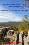
05/03/2014: "The Mid-Atlantic Hiker's Guide: Central Maryland" is now finished. It includes 45 day hikes from the shores of the Chesapeake Bay to Catoctin Mountain and from the Potomac River to the Mason-Dixon Line. The one hundred and eighty-four page book uses the same format as the West Virginia book (below). Orders are being taken.
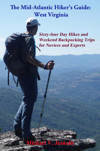
After two years of hard work my first book is finally finished - Orders are now being accepted: The Mid-Atlantic Hikers Guide: WV. I've teamed up with Scott Adams Enterprises to produce a two hundred and eighty-nine page manuscript complete with large topo maps, elevation profiles and waypoint tables, all keyed together to totally integrate the hiking experience. There are sixty-four hikes in all, ranging from a 2 mile flip-flop walk to visit the beautiful Sandstone Falls on the New River to 25+ mile, three day, strenuous forays into the wilderness areas of the Mountain State, and all other kinds of hikes in between.
___________________________________________________ M. R. Hyker's Latest Adventure(s) |
|
|
This portion of the website has been temporarily suspended. |
|
________________________________________________________________________________________________ |
|
Latest Outing Critiques
Outing Critique: Due to getting a
late start, I opted to hike just the ridgeline portion along the
AT. I tried to find the northern most parking lot as marked on the
map but did not see it, so I parked at the middle one where rt. 638
makes a sharp turn right (coming from the west.)
Outing Critique: I went out on a solo
overnight hike on the LHHT and planned to make it from mile 0 to
mile 11.5 and turn around and camp at the Ohiopyle (mile 6.5)
shelters. It was warm for late April, with high temps near 80. The
leaves were just starting to come in so the sun was very hot too!
Outing Critique: My husband and I hiked this as a 1-night backpack. We started out from the parking area at Lake Perez going the direction described in the trail notes. The trails within the S.V.R.A. were blazed with different symbols than described (I think it was yellow stick people instead of yellow arrows, or some thing like that) but were extremely easy to follow regardless. We decided to dry camp on the ridge of Tussey Mountain, at the site marked 2.03 miles into Jackson trail, to even out the mileage for each day. We planned to fill up on water from the stream before the climb, but it was either dry or farther from the trail than we thought. Luckily we came across a trickle, although our water pump broke and we had to carry dirty water to camp and boil it instead. The climb up to the ridge was very steep but not too long, and the ridge was extremely rocky, as advertised. I'm pretty sure we stayed at the camp site described as hidden in the hemlocks, but we also may have missed that particular site, because the one we found was definitely not hidden. There were 3 fire rings and multiple spots you could put a tent, but it looks like it is a popular teen/college hangout based on the trash, broken glass, and obvious cutting of standing trees for firewood--we were pretty close to Rte 26 so I think a lot of people just walk in from the road. There were a few potential spots we could have stopped prior to this, but not many due to the rocks. Even so, the camp location was amazing and we were able to see the sunset, stars, moon, and sunrise all from the pair of overlooks. There was a burn ban, so we brought our stove to the overlooks for dinner and breakfast with a view instead of cooking on the fire. On day 2 we completed the loop. The descent and ascent were, again, very steep but having rock and log steps helped. Overall, we had a fantastic trip--highly recommend this one!
Outing Critique: Did this as a two
night trip, starting at sunset Friday and hiking out noon Sunday.
Worked great as a first of the season backpacking trip, as well as
an introduction to backpacking for two of our companions. First
night we hiked to the base of the first steep climb and made camp an
appropriate distance off the trail. Second day started with that
climb, then a very pleasant mostly level hike along the ridge. This
track lacks great vistas, but otherwise has some interesting
passages through the old coal mine(s?) area. Second night spent
north of the resevoir.
Outing Critique: The primary
reason for this critique is to report that the blazing around
the lost pond is now complete and easy to follow, as is the
"sharp right turn" the previous reviewer missed, as long as you
understand traditional trail markings (two blazes, one above the
other, with the upper one on the right means "turn right"). I
don't doubt this is a recent addition; I did this hike not too
long ago and had the exact same problem. Yay for trail
maintenance!
Outing Critique: A beautiful hike on
a beautiful day! The bluebells were astounding along the river.
Just SO many! The trail intersections are all well marked. Do not
ignore traditional blaze turn signals (for new hikers: one blaze
above another, turn in the direction the upper blaze is on), or you
will miss the turn where the yellow trail cuts away from the river.
A very clearly defined trail continues straight beyond that point,
just after a stream crossing, but turning right is the right thing
to do there. Just follow the blazes!
Name: GaliWalker
Outing Critique: Just completed this
hike a few days ago, I also did it in 2 days/1 night, although when
I set out I had planned on 3 days / 2 nights - but decided to push
harder with some nasty weather moving in. Grindstone Campground was
closed so I parked in the small lot right across from the Mt Rogers
Trail Head. My vehicle was fine when I came back, but this parking
area is very close to the road so be wary. Most of the elevation
gain is experienced in the first few miles, and the views after
about 4 or 5 miles are well worth it. I would classify this as an
easy to moderate hike. The ponies were very cool, and it was very
windy.
Outing Critique: I hiked this on a
Friday in late September and had the park virtually to myself. I
enjoyed the multiple overlooks and did some rock scrambling on
Chimney Rock. I accidentally took a wrong turn and added a two mile
down and back to Camp Airy (the trail is not on the Park Service
map).
Outing Critique: I hiked the Riprap trail clockwise starting at the
Riprap trailhead. I opted to do the “boring” AT part first and work
up a sweat before hitting the swimming hole. The AT lived up to
expectations with only one slight overlook providing a preview of
the mountain that would need to be climbed at the end of the hike.
The Wildcat Ridge Trail was an easy descent into the hollow and had
a few overlooks. The last mile follows a small stream until the
junction with the Riprap trail. From there the last 3ish miles were
all uphill, although there was only one steep section.
Outing Critique: I attempted this hike with my husband and his aunt. She hasn't done a lot of backpacking, especially recently, so we thought the relatively low and flexible mileage on this one would make it a good choice. However, the first section of the trail (up until you reach hemlock road for the first time) has clearly not been maintained for many years. There were countless downed trees across the trail and areas where we had to search for blazes when the trail seemed to just disappear. That section, plus the steep descent on rocks covered with slippery fallen leaves once we reached the Tuscarora trail, put us so far behind schedule (despite having very generous time allowances) that we ended up camping at the shelter on the Tuscarora. It was a great shelter, with a fantastic fireplace that kept us warm in the chilly night & morning air, water source, and nearby privy. On day 2 we had way too much ground of unknown quality to cover so we decided to follow the Perry & Twig trails to hemlock road, then just walk on the road back to the car. Overall it was disappointing, but I would attempt it again, bypassing the initial section by walking on hemlock road to reach the Tuscarora trail. Seems like it would be a nice hike if we could have completed it, so my ranking might be unfairly low..
|